From Rifugio G. Angelini - Sora’l Sass to Passo Duràn
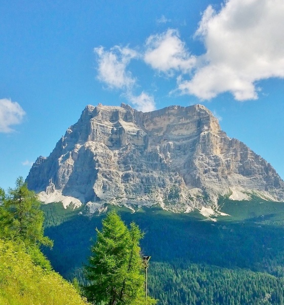
From Rifugio Sora ’l Sass, the second day begins in the midst of meadows and dwarf pines, with the Mezzodì Mountain Group behind you and, opposite, the first views of the San Sebastiano Chain.
Trail 534 is the common thread of this stage and offers two paths to Val Prampèr: a more direct technical one for experienced hikers; and a gentler descent, though with slightly greater elevation gain.
Variant for experienced hikers
South, following trail 534, at altitude, you walk up to the right edge of the Mezzodì North Gorge. The path then descends steeply on the valley side, passing some rocky drops, not difficult though exposed, equipped with wire ropes, until you reach the bottom of the gorge. Continuing along trail 534, you come out among gravel and pines and reach the Prampèra stream, located in Pian de La Fópa, crossing it on a small wooden bridge (approx. 1,200 m, 1 hour). Then climb to Val Prampèr along the valley-floor road leading to Pian dei Palúi (about 1 hour and 45 min in total).
Normal variant
Alternatively, from Rifugio Angelini, enter the forest northbound and follow trail 534 downhill to the Casèra di Mezzodì bench pasture (1,349 m). Here, step off trail 534, which runs to Forno, and then turn sharply left (west) onto trail 525, which slopes down gradually to Val Prampèr as far as Castelàz (996 m, 1 hour). Then go up the valley along the road, past Pian de La Fópa, and reach the northern edge of Pian dei Palúi (approx. 1,480 m, about 2 hours); this variant adds about 300 m elevation gain, but you can avoid the most exposed stretches.
The spectacular long traverse below San Sebastiano begins from Pian dei Palúi. After leaving the road, take trail 536 on the right (west), a Zoldo variant of Alta Via no. 1 heading north. After crossing a talus slope of large blocks (the “masaréi”), the track climbs sharply to Col de Mechìel (1,491 m), where trail 535 coming from Pralongo joins on the right. Trail 536 continues westwards, giving start to the wide San Sebastiano bypass: a short descent into a rocky gully that needs to be tackled cautiously due to the gravelly and crumbly soil (equipped with a fixed rope), followed by a not difficult but exposed section (the “Viàz de l’Ariosto”), introducing you to a stern and fascinating environment.
Further on, you meet trail 524 coming from Pralongo; after a steep stretch, you reach a fork in the trail; ignore the left branch (524), which climbs to the Vant de Le Forzéle, and continue along trail 536 to the V. Angelini bivouac (1,680 m, about 4 hours), at the spring of Aiva dei Scarselóin. A few uphill and downhill stretches among dwarf pines and a steeper descent lead to Vant dei Gravinai, beyond which you reach Forcella della Val Barance (1,688 m, 5 hours); here, from the right, trail 539 joins from Colcervèr.
A final section running through the woods, with gentler ascents and descents at high altitude, finally leads to Passo Duràn (1605 m, provincial road 347) and to the San Sebastiano and the Passo Duràn C. Tomè” alpine refuges (6 hours and 30 min), ending an extraordinarily panoramic stage.