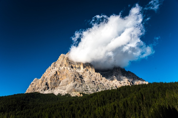
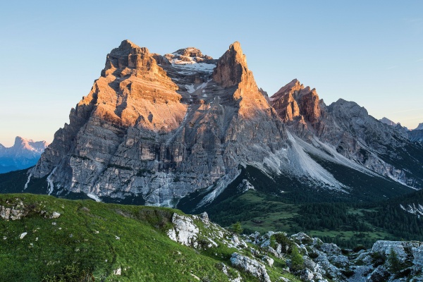
The Alta via n. 3 called "of the chamois" begins at Dobbiaco and arrives in Longarone. It is 100 km long, divided into 8 legs. It requires 41 walking hours to climb up 6200 m in total (6800 m in descent) through 5 mountain ranges: Picco di Vallandro, Cristallo, Sorapìss, Pelmo and Bosconero. Passes through Dolomiti di Zoldo on: the 5th leg (from rifugio De Luca to Passo Cibiana), the 6th (from passo Cibiana to rifugio Casera Bosconero) and the 7th (from rifugio Bosconero to the Tovanella bivouac).
The 8 days:
- Day 1: from Villabassa-Niederdorf to Rifugio Vallandro-Dürrensteinhütte
Gradient: 1500m in ascent, 620m in descent
Lenght: about 17 km
Time required: 8 h
Path: 27, 15, 16, 33, 40, 37, SS 51
Difficulty: EE (for expert hikers)
- Day 2: from Rifugio Vallandro to Rifugio Vandelli
Gradient by walking: 370m in ascent, 890m in descent
Gradient on road: 510m in ascent, 110m in descent
Lenght: about 12 km on path; then 15 km on road
Time required: 5 h (and the time to cross the 15km by car)
Path: 34, SS 48b and 48, 215
Difficulty: EE (for expert hikers), brief part EEA (for expert hikers with via ferrata equipment)
Variant 1: from Rifugio Vallandro to Rifugio Vandelli via la Val di Specie, Carbonìn, Statali 48b and 48 via Misurìna and Passo Tre Croci
Variant 2: from Val di Landro to Passo Tre Croci via Val Popéna and Rifugio Vandelli
- Day 3: from Rifugio Vandelli to San Vito di Cadore
Gradient: 600m in ascent, 1505m in descent
Lenght: about 18 km
Time required: 7 h
Path: 215, 216, 223, 214, 426
Difficulty: EE (for expert hikers), brief part EEA (for expert hikers with via ferrata equipment)
Variant 3: from Rifugio Vandelli to San Vito di Cadore via Percorso alpinistico attrezzato “Francesco Berti”
- Day 4: from San Vito di Cadore to Rifugio Venezia
Gradient: 990m in ascent, 55m in descent
Lenght: about 10 km
Time required: 3,30 h
Path: 470
Difficulty: E (for hikers)
- Day 5: from Rifugio Venezia to Rifugio Remauro-Forcella Cibiàna
Gradient: 500m in ascent, 900m in descent
Lenght: about 15 km
Time required: 6 h
Path: 471, 475, 493, 456, 494, 478, 479
Difficulty: EE (for expert hikers)
- Day 6: from Rifugio Remauro-Forcella Cibiàna to Rifugio Casèra di Bosconero
Gradient: 460m in ascent, 540m in descent
Lenght: about 6 km
Time required: 3,30 h
Path: 483, 485
Difficulty: EE (for expert hikers)
- Day 7: from Rifugio Casèra di Bosconero to Bivacco Tovanella via Viàz de le Pónte
Gradient: 1040m in ascent, 820m in descent
Lenght: about 8 km
Time required: 5 h
Path: 490, 482
Difficulty: EE (for expert hikers), part EEA (for expert hikers with via ferrata equipment)
- Day 8: from Bivacco Tovanella to Longarone in Val di Piave
Gradient: 150m in ascent, 1030m in descent at Podenzoi, 1365m at Longarone
Lenght: about 10 km until Longarone
Time required: 3 h
Path: 482
Difficulty: E (for hikers) and T (elementary diffuculty)
N.B. Organise in the best way your trip in the Dolomites. During your personal organisation of the itinerary before your start, please verify the weather forecasts, the opening and the availability of the refuges.